


Mohammad Bin Rashid Space Centre (MBRSC), a Dubai government entity related to the UAE’s space programme, has released the first satellite pictures of the completed Dubai Water Canal.
The high definition images, taken by DubaiSat-2, show water flowing from Dubai Creek towards the Arabian Gulf.
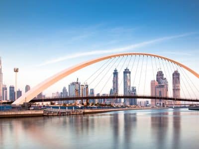
On October 25, water was released into the new stretch for the first time by the Roads and Transport Authority (RTA) as part of a testing process. The official opening is expected by end-November.
During the three-year development period, three new bridges have been built, one of which has raised Sheikh Zayed Road over the canal.
When fully opened, boats and ferries will be able to work their way from the original mouth of the Creek all the way through the city and back out at what was once Jumeirah Beach Park.
DubaiSat-2 was launched to provide high-resolution images and is capable of taking multiple images of the same area.

Follow us on